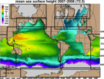
| Title: | HYCOM GLBu0.08 |
| Resolution: | 1/12° (~0.08) |
| Institution: | Naval Research Laboratory |
| Date/Data Range: | Apr-18-2016 to Nov-20-2018 [missing data] |
| Experiment: | 91.2 |
| Computational Grid: | Uniform (1/12° resolution) grid between 80.48°S and 80.48°N |
| Temporal Frequency: | daily (hindcasts), 3 hourly (forecasts) |
System Description
This dataset is created at NRL and provided "as is".
How It's Generated:
- NRL interpolates the archive file from GLBa0.08 to GLBu0.08, using isubaregion. Note that this now reads in a "gmap" file that defines the mapping between the two grids. Therefore, isubaregion only does the interpolation (isuba_gmapi, only run once, calculates the actual bi-linear remapping weights).
- Next, NRL runs archv2ncdf3z on the resulting file using the new "NAVO" (netCDF) output type (interpolated to 40 standard z-levels). Only five fields provided: SSH, eastward velocity, northward velocity, temperature, and salinity. Note: NRL writes out in-situ temperature, not potential temperature.
- Note: NAVO may also add externally generated tidal components.
- Topography
- NRL interpolates this data to a uniform 0.08 degree lat/lon grid between 80.48S and 80.48N. GLBa0.08 uses the native Mercator-curvilinear HYCOM grid whereas GLBu0.08 is the constant .08 deg lat/lon grid onto which the netcdf files have been interpolated (in the horizontal and vertical). This type of grid is easy to use with GIS tools, and it starts at -180.0E because this works best in ARCOAS.
- NAVO's netCDF Format
- This format uses short ints to store the fields (which saves space).
Data Assimilation
The system uses the Navy Coupled Ocean Data Assimilation (NCODA) system (Cummings, 2005, Cummings and Smedstad, 2013) for data assimilation. NCODA uses the model forecast as a first guess in a 3D variational scheme and assimilates available satellite altimeter observations (along track obtained via the NAVOCEANO Altimeter Data Fusion Center) satellite and in-situ Sea Surface Temperature (SST) as well as available in-situ vertical temperature and salinity profiles from XBTs, ARGO floats and moored buoys. MODAS synthetics are used for downward projection of surface information (Fox et al., 2002).
Operational Details
The system runs daily at the NAVO HPC and generates a 5 day hindcast and a 5 day forecast. The data are made available typically within two days after the model run via servers located at the Center For Ocean-Atmospheric Prediction Studies (COAPS), Florida State University (FSU). The HYCOM format archive files are converted to CF 1.0 compliant NetCDF files using standard HYCOM post-processing package. These files contain diagnostic output at standard Levitus depth levels for several variables including: currents, temperature and salinity. The archive files are snapshots.
Detailed Information
- Run Configuration (blkdat.input)
- Contains model run configuration information such as time steps, advection scheme, mixing, vertical structure, etc.
- Model Bathymetry (depth.[ab])
- Files containing the model bathymetry.
- Computational Grids (regional.grid.[ab])
- Files containing the location of model grid point.
References
- NRL Website
- Contains snapshots, animations forecast verification statistics and model data comparisons.
- (Cummings and Smedstad, 2013)
- J. A. Cummings and O. M. Smedstad. 2013: Variational Data Assimilation for the Global Ocean. Data Assimilation for Atmospheric, Oceanic and Hydrologic Applications vol II, chapter 13, 303-343.
- (Cummings, 2005)
- Cummings, J.A., 2005: Operational multivariate ocean data assimilation. Quart. J. Royal Met. Soc., Part C, 131(613), 3583-3604.
- (Fox et al., 2002)
- Fox, D.N., W.J.Teague, C.N. Barron, M.R. Carnes, and C.M. Lee, 2002. The Modular Ocean Data Assimilation System (MODAS). J. Atmos. Ocean. Technol., 19, 240-252.


