* L E G A C Y *
Please use NAVGEM 2.0
The Naval Research Lab (NRL) - Monterey developed a new atmospheric forecast model, the NAVy Global Environmental Model (NAVGEM) that replaced the Navy Operational Global Atmospheric Prediction System (NOGAPS). It initially run at T359L50 resolution (with planned resolution upgrades) and has a new and improved dynamical core. NAVGEM version 1.1 was transitioned to the Fleet Numerical Meteorology and Oceanography Center (FNMOC) and completed its Operational Test in January 2013. The results show an across the board improvement in forecast skill over NOGAPS and it became the US Navy's new operational atmospheric forecast system on 13 March 2013 12Z.
NRL-Monterey and FNMOC have a very aggressive upgrade cycle for NAVGEM in which the model physics will improve and spectral resolution will increase. Currently (28 April 2014) NAVGEM 1.2 is the operational system.
The Global Ocean Forecast System (GOFS) runs daily at the Navy DoD Supercomputing Resource Center (DSRC) and currently uses NAVGEM forcing, but previously used NOGAPS forcing. Comparisons made between NOGAPS and NAVGEM showed that their surface differences were large enough that we could not simply switch products and expect the ocean model response to be unchanged. Because of these large surface heat flux and wind inconsistencies, great care was taken when switching from NOGAPS to NAVGEM. This NRL Memorandum Report details what was done in the operational GOFS to mitigate spurious upper ocean response using different atmospheric forcing.
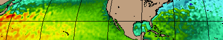
***The user needs to be aware that there can be large differences in the surface winds and heat fluxes between successive versions of NAVGEM.***
Currently hycom.org serves several different HYCOM-ready forcing products, see http://hycom.org/dataserver. Among these are the old NOGAPS output, NCEP CFSR output and NAVGEM output. The NAVGEM directories will include a version number to differentiate the products.
The files in navgem0.5a start at various times depending upon the version and how long of a hindcast NRL-MRY ran. They do not contain any forecasts. When we process forcing products, we'll put all variables into their own files, and additionally we'll merge certain variables because that is what the interpolation code expects. For a specific year, we have these fields like:
navgem0.5a-std_2013_03hr_conice.D
navgem0.5a-std_2013_03hr_dwpt2m.D
navgem0.5a-std_2013_03hr_longwv.D
navgem0.5a-std_2013_03hr_mslprs.D
navgem0.5a-std_2013_03hr_sensht.D
navgem0.5a-std_2013_03hr_soiltm.D
navgem0.5a-std_2013_03hr_solrad.D
navgem0.5a-std_2013_03hr_solrad_noaliascorrect.D
navgem0.5a-std_2013_03hr_spchum.D
navgem0.5a-std_2013_03hr_strblk.D
navgem0.5a-std_2013_03hr_strpbl.D
navgem0.5a-std_2013_03hr_Taqa_day-QrQp.D
navgem0.5a-std_2013_03hr_TaqaQrQp.D
navgem0.5a-std_2013_03hr_temp2m.D
navgem0.5a-std_2013_03hr_ttlpcp.D
navgem0.5a-std_2013_03hr_uv-10m.D
navgem0.5a-std_2013_03hr_vprprs.D
navgem0.5a-std_2013_03hr_wndspd.D
- TaqaQrQp:
- a merged file of temp2m (air temp at 2m), spchum (specific humidity), radiative fluxes that is composed of solrad (net surface shortwave) minus longwv (net surface longwave) and penetrating radiation (solrad). This field is the input thermal forcing file for a HYCOM simulation. The fields in this file have a daily filter applied to them.
- Taqa_day-QrQp:
- These are like the TaqaQrQp daily filtered files, but Ta and qa are NOT daily filtered whereas QrQp ARE daily filtered.
- TaqaQlQg:
- These files are used by CICE when running coupled HYCOM/CICE. Taqa are the same as in the TaqaQrQp files, but Ql is net surface longwave radiation and Qg is downward surface shortwave radiation (glbrad).
- dwpt2m:
- dewpoint temperature at 2 m (Kelvins)
- lndsea:
- the atmospheric model's land/sea mask
- longwv:
- net surface longwave (W/m^2)
- mslprs:
- mean sea level pressure (hPa/100 - 1000)
- soiltm:
- surface (land and ocean) temperature (Kelvins)
- solrad:
- net surface shortwave (W/m^2)
- spchum:
- specific humidity (kg/kg)
- strblk:
- bulk-derived wind stress (N/m^2)
- strpbl:
- planetary boundary layer wind stress (N/m^2)
- temp2m:
- air temperature at 2 m (Kelvins)
- uv-10m:
- zonal and meridional wind components (m/s)
- wndspd:
- wind speed (m/s)
The lndsea files is actually dynamic for navgem0.5a with: 0 = OCEAN, 1 = LAND, 2 = ICE, 3 = SNOW.
Often the wind stress curl field associated with the strpbl file is very noisy so traditionally we have always used the strblk stresses to force HYCOM. Nonetheless, we keep both sets of stresses.
For the set of files listed above, there are navgem0.5a-sea versions. For the QuikSCAT corrected winds and stresses, these are the 'sec' files. Note there are secC and secD versions. For uv-10m and wndspd, the secC are the appropriate files to use but for strblk the secD file is appropriate. For simplicity, we simply call them sec (without the C or D).
e.g.,
navgem0.5a-sea_2013_03hr_strblk.D
navgem0.5a-sea_2012_03hr_uv-10m.D
navgem0.5a-sea_2012_03hr_wndspd.D
| File | Authors | Source | File size | Created |
|---|---|---|---|---|
| Frank Bub | NAVOCEANO | 989 kB | 2013 | |
| Metzger,Wallcraft,Posey,Smedstad,Franklin | NRL | 5367 kB | 2014 |