System Description
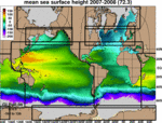
The system is configured for the global ocean with HYCOM 2.2 as the dynamical model. Computations are carried out on a mercator grid between 78°S and 47°N (1/12° equatorial resolution). A bipolar patch is used for regions north of 47°N. The horizontal dimensions of the global grid are 4500 x 3298 grid points resulting in ~7 km spacing on average. There are 32 vertical layers (see blkdat.input). Bathymetry is derived from a quality controlled NRL DBDB2 dataset. Surface forcing is from NAVy Global Environmental Model (NAVGEM) version 1.3 and includes wind stress, wind speed, heat flux (using bulk formula), precipitation. For additional details on the model configuration such as layer reference densities time steps, advection scheme, mixing etc. see blkdat.input.
Previous real-time versions of HYCOM + NCODA Global 1/12° Analysis (GLBa0.08-90.X) used NOGAPS atmospheric forcing. This presentation documents some validation metrics comparing NOGAPS-forced HYCOM against NAVGEM-forced HYCOM for a contemporaneous time period. The bottom line: the score card data indicate that NAVGEM forcing results in an improved HYCOM.
Notes:
- All data have been transformed from the Arakawa C-grid staggering to cell centers. Velocity components have been rotated (where necessary) to be everywhere eastwards and northwards.
- An analytic diurnal cycle is applied to the shortwave radiation forcing.
- The data provided are snapshots at 00Z.
Data Assimilation
The system uses the Navy Coupled Ocean Data Assimilation (NCODA) system (Cummings, 2005, Cummings and Smedstad, 2013) for data assimilation. NCODA uses the model forecast as a first guess in a 3D variational scheme and assimilates available satellite altimeter observations (along track obtained via the NAVOCEANO Altimeter Data Fusion Center) satellite and in-situ Sea Surface Temperature (SST) as well as available in-situ vertical temperature and salinity profiles from XBTs, ARGO floats and moored buoys. MODAS synthetics are used for downward projection of surface information (Fox et al., 2002).
- Incremental updating over 6 hours, from the NCODA analysis at 18Z the previous day until 00Z
- NCODA analysis and assimilation over basin-wide areas in the Mercator part of the grid and separate polar regions
- Time window for profile assimilation: -12 days to +12 hours
- MODAS is a U.S. Navy product and is not available for public distribution
Operational Details
The system runs daily at the NAVO HPC and generates a 4 day hindcast and a 7 day forecast. The data are made available (typically) within two days after the model run via servers located at the Center For Ocean-Atmospheric Prediction Studies (COAPS), Florida State University (FSU). The HYCOM format archive files are converted to CF 1.0 compliant NetCDF files using standard HYCOM post-processing package. These files contain diagnostic output at standard Levitus depth levels for several variables including: currents, temperature and salinity. The archive files are snapshots.
Detailed Information
- Run Configuration (blkdat.input)
- Contains model run configuration information such as time steps, advection scheme, mixing, vertical structure, etc.
- Model Bathymetry (depth.[ab])
- Files containing the model bathymetry.
- Computational Grids (regional.grid.[ab])
- Files containing the location of model grid point.
References
- NRL Website
- Contains snapshots, animations forecast verification statistics and model data comparisons.
- (Cummings and Smedstad, 2013)
- J. A. Cummings and O. M. Smedstad. 2013: Variational Data Assimilation for the Global Ocean. Data Assimilation for Atmospheric, Oceanic and Hydrologic Applications vol II, chapter 13, 303-343.
- (Cummings, 2005)
- Cummings, J.A., 2005: Operational multivariate ocean data assimilation. Quart. J. Royal Met. Soc., Part C, 131(613), 3583-3604.
- (Fox et al., 2002)
- Fox, D.N., W.J.Teague, C.N. Barron, M.R. Carnes, and C.M. Lee, 2002. The Modular Ocean Data Assimilation System (MODAS). J. Atmos. Ocean. Technol., 19, 240-252.
|


